Frequently Asked Questions and Background Information
- Wildfire Mitigation Strategy
- Mountain Pine Beetle Program
- Events that include FireSmart education opportunities are posted on the County’s online Events Calendar.
- The County’s website includes information on FireSmart.
- The County’s website includes information on our Wildfire Mitigation Strategy.
- The County’s website includes information on the Mountain Pine Beetle Program.
- The County Connections Newsletter includes information on these programs and any opportunities to learn and engage.
- For more information, contact the Fire Marshal at 780-532-9727.
1. What is the Fire Smart program and what are the FireSmart guidelines?
FireSmart is a planning tool that helps to reduce wildfires from happening in our community. It is built on partnerships between the County, the Provincial Government, local industry and homeowners.
The County of Grande Prairie has two main preventative strategies and programs for FireSmart that help keep our community safe:
2. What is the Wildfire Mitigation Strategy?
The Wildfire Mitigation Strategy works to lower the risk of wildfire or, in the case of a wildfire, reduce the risk of loss of life and damage to infrastructure. The strategy works alongside the County’s other FireSmart programs and efforts to prevent fires and make our community a safe place.
3. What is the Mountain Pine Beetle Program?
Mountain pine beetle management and a healthy pine approach have been a goal in the County of Grande Prairie since beetles were discovered in the municipality in 2006. When mountain pine beetles infest trees, the tree dies and their needles turn red. These red needles have ten times less moisture than healthy foliage, and red needles ignite four times faster than green needles. As a result, forests with a large number of beetle-killed trees are at a higher risk of wildfires.
4. When was the Wildfire Mitigation Strategy created?
In 2010, the work towards reducing wildfires started with the Mountain Pine Beetle Program in the Wapiti Dunes area. By focusing on the priority areas like Wapiti Dunes and Aspen Ridge, the County created an action plan to ensure all program areas were included.
County staff worked alongside registered foresters, Alberta Forestry, County residents, community/user groups, First Nations and major industrial stakeholders to develop the plan. The risk levels of forested areas were assessed, and the steps created to lower the wildfire risk.
County Council approved the Wildfire Mitigation Strategy in 2015. Since then, the County has been taking action, in order of priority, on a number of FireSmart vegetation management projects.
5. Why is a Wildfire Mitigation Strategy needed in the County of Grande Prairie?
As the coniferous forest matures and Mountain Pine Beetle infestation continues, the amount of forest fire fuel and the risk of wildfires have increased considerably in the last few years. At the same time, recreational use of Crown land in the County has also increased causing an increased number of recreational fires. As the County continues to grow and develop, the need for a more formal, approved approach to wildfire mitigation has not only increased dramatically but is essential to all that work, live and play on or near forested land.
Essentially, this strategy reduces the wildfire risk to all areas where County residents live, work and play.
6. What physical areas of the County are referred to in the Wildfire Mitigation Strategy?
Although the strategy focuses on wildfire fuel reduction on Crown (provincial) and County owned lands, there is a component of mitigation that applies to private land. This is particularly true for land that is embedded or borders forested Crown land. As such, the strategy covers all 5,863 square kilometres of land in the County.
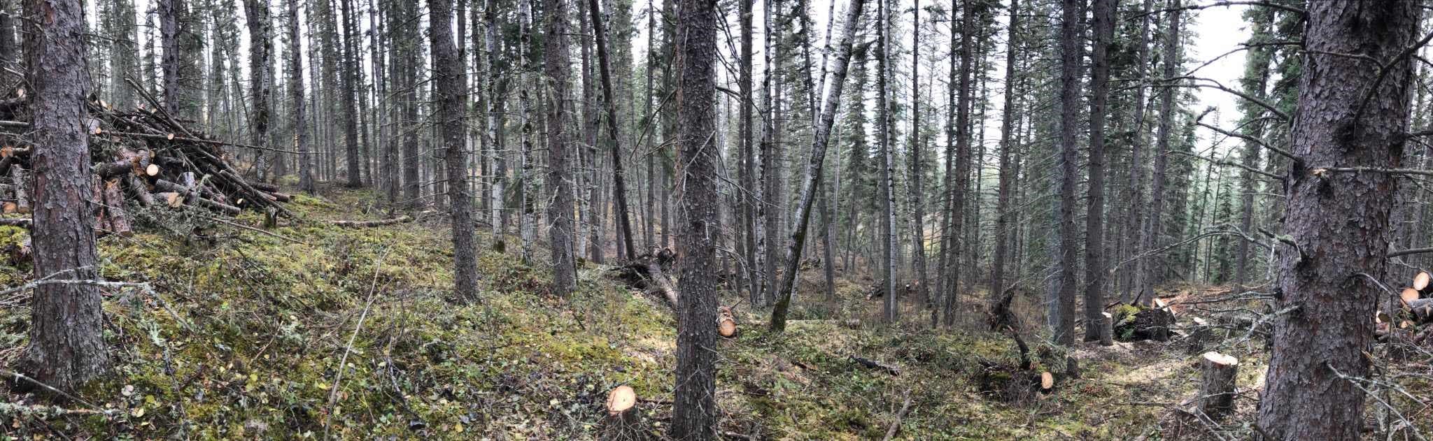
7. What is ‘fuel’ in relation to wildfires?
Wildfires rely on fuel to spread quickly. In this case, fuel is any organic matter, living or dead, in the ground, on the ground, or in the air that can ignite and burn. This includes woody debris, deadfall, dead standing trees, and leaf piles.
8. What FireSmart projects have been prioritized in the Wildfire Mitigation Strategy?
Numerous priority areas were identified in the strategy and so far, the County has addressed the following:
Priority 1: The Dunes and Aspen Ridge Area
Patches of dead trees were removed and the harvested timber was sold to off-set the project costs. The Aspen Ridge work was completed in 2017.
Priority 2: Southeast of Bear Creek
Where possible, harvested timber was again sold to off-set the project costs. This work was completed in 2018.
Priority 3: Highway 40 West
This planning and education project is launching in the spring of 2021. The rural subdivisions in the general area include The Ranch, Dunes West, Deer Ridge Estates and Mystic Ridge. There are also recreational and grazing leases. This phase includes planning, engagement and public education.
9. What can I expect in the Priority 3 work underway this spring?
The Wildfire Mitigation Strategy, approved by Council in 2015, is moving onto Priority 3 this summer with three strategies of planning, engagement and public education for the Highway 40 West area.
This phase includes mapping of the public lands in this area and planning for future vegetation management. No vegetation management will take place at this stage. Following the mapping and assessment, the County will present the results and a recommended action plan for future work in the area to mitigate the risk of wildfire. A number of virtual engagement sessions will be available for residents to provide feedback.
Virtual education sessions will take place May 10 and 11 to provide opportunities for any members of the public to learn about FireSmart, why wildfire management work is important and what it involves.
10. Who is involved in the development and implementation of the Wildlife Mitigation Strategy?
The County has been working with Alberta Agriculture and Forestry for a number of years to minimize the fire hazard and risk on Crown land within the County’s boundaries. However, we all have a part to play in wildfire mitigation.
11. What can I do as a resident to reduce the risk of wildfire?
Every resident of the County has a shared responsibility to lessen the effects of wildfires while, at the same time, prepare for the threat of wildfires in the County. Every household and business needs to remove deadfall, standing dead trees, excess wood and leaves from their property.
It is also important that all County residents educate themselves on FireSmart actions they can take to protect their homes and the homes of their neighbours. The public can help protect private property and Crown lands from wildfire by responsible operation of Off-Highway Vehicles (OHVs), not lighting campfires in banned areas, and respecting fire bans.
12. How can residents find out more about FireSmart, the Wildfire Mitigation Strategy and what we can do?
Public involvement and action on reducing exposure to the risk of wildfire is an important part of the FireSmart program. The County provides a number of opportunities to educate home and business owners throughout the year. There are a number of ways to learn more.
Subscribe to Latest News from the County of Grande Prairie to stay up to date on future wildfire mitigation work.
13. How are the projects within the Wildfire Mitigation Strategy funded?
Funding has been made possible with grants from Alberta Forestry, the Forest Resource Improvement Association of Alberta (FRIAA), and revenue from timber harvest. The County also contributes funding towards implementation of the Strategy.
14. Will there be work done from Range Road 63 east?
From Range Road 63 east to Highway 40, there are areas of public lands that must be assessed during this project. When you look at the map of the Project Area you will see that the red diagonal lines are public lands to be assessed by the forestry consultant hired by the County of Grande Prairie. Until that assessment is completed, we do not know what work, if any, is needed.
15. How do we make a request for a fire break east of Deer Ridge Estates?
Thank you for sharing your concern about the area east of Deer Ridge Estates. The forestry consultant hired by the County will pay close attention to all areas, including east of Deer Ridge Estates, in his assessment. The road east of Deer Ridge is already a good fire break. Treatment to the wooded area across the road will potentially decrease the fuel and the intensity of any wildfire in that area. There are several factors to consider when determining the best treatment for an area and this request will be considered in the assessment.
16. Is there an app for my smart phone to help assess the wildfire risks on my home and property?